My Town Tutors is a great resource for parents & teachers. Find qualified tutors in your area today!
March Guest Blogs / Top Guest Blogs / March Jokes / Top March Pages
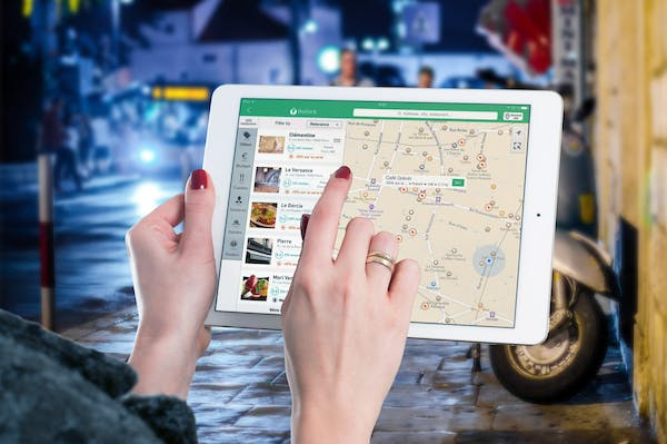
In an ever-evolving digital landscape, the ability to contextualize data through geographical mapping is becoming increasingly important. Businesses and developers can enhance the functionality of their applications significantly by integrating geocoding services. In this detailed exploration, we’ll delve into the strategies for selecting the right geocoding API for your needs, enhancing user experiences through geolocation services, and the benefits of geocoding for business marketing and operations.
Geocoding Integration Strategies: Choosing the Right API for Your Needs
When it comes to geocoding integration, the selection of an appropriate API is a critical decision that can define the success of an application’s location-based services. The right geocoding API can transform raw data into actionable insights, enabling applications to deliver personalized and context-aware experiences to users.
Understanding Your Application’s Geocoding Needs
Before selecting a geocoding API, it is essential to understand the specific needs of your application. Does your application require real-time geocoding for dynamic content, or is batch geocoding sufficient? Will the application operate on a global scale or focus on a particular region? Answering these questions helps narrow down the list of suitable APIs.
Comparing Geocoding API Features and Pricing
Once the application’s needs are clear, the next step is to compare the features and pricing of various geocoding APIs. Key considerations include the accuracy of geocoding results, the speed of response, the ease of integration, and the level of customer support provided. Additionally, evaluating the cost against the budget is important as some APIs offer pay-as-you-go pricing while others may have a subscription model.
Evaluating API Performance and Scalability
The selected geocoding API should not only meet current requirements but also be capable of scaling as the application grows. Performance benchmarks, such as uptime guarantees and rate limits, should be assessed. Moreover, it is crucial to ensure that the API provider has a robust infrastructure that can handle increased demand without compromising performance.
Enhancing User Experience with Geolocation Services
Geolocation services powered by geocoding APIs are at the forefront of creating intuitive and engaging user experiences. By understanding a user’s location, applications can deliver relevant content, offer location-based recommendations, and improve overall service delivery.
Personalization Through Location Awareness
A geocoding API allows applications to personalize the user experience by providing location-aware content. For instance, a shopping app can suggest nearby retail stores, or a travel app can provide information on local attractions. This level of personalization is not only convenient for users but also enhances their engagement with the application.
Improving Navigation and Accessibility
Navigation and accessibility are vital components of the user experience. A geocoding API can facilitate seamless navigation by providing accurate and up-to-date maps and directions, allowing users to find their desired destinations effortlessly. This is particularly useful for applications focusing on transportation, logistics, or tourism.
Enhancing Social Connectivity and Interactions
Geolocation services also play a significant role in enhancing social connectivity. Social networking applications can use geocoding to enable users to check in at locations, share their whereabouts with friends, or discover events happening near them. These interactions, driven by location intelligence, can significantly boost the user’s engagement with the app.
Implementing Geofencing and Location-Based Notifications
Geofencing is a technology that creates virtual boundaries around a geographical area. When combined with geocoding APIs, it can trigger location-based notifications, providing users with timely and relevant information based on their proximity to a specific location.
Creating Dynamic Geofences for Real-Time Engagement
By implementing dynamic geofences, applications can interact with users in real time. For example, a retail app can send a promotional notification when a user is near a store, or a security app can alert users if they enter a high-risk area. These real-time engagements make the application more interactive and responsive to the user’s context.
Tailoring Notifications to User Preferences
To maximize the effectiveness of location-based notifications, it is important to tailor them to user preferences. Notifications should be relevant, timely, and non-intrusive. By allowing users to set their preferences for receiving notifications, applications can ensure that these alerts are welcomed rather than seen as a nuisance.
Analyzing User Behavior with Geofencing Data
The data collected from geofencing can provide valuable insights into user behavior. By analyzing how users interact with location-based notifications, applications can refine their strategies to better target and engage their audience. This analytical approach can lead to improved user retention and higher conversion rates.
Geocoding for Business: Utilizing Location Intelligence for Marketing and Operations
For businesses, geocoding is more than just a tool for mapping; it’s a powerful component of location intelligence that can drive marketing strategies and streamline operations. By leveraging geocoded data, companies can gain a competitive edge in the market.
Targeted Marketing Campaigns with Geocoding
Geocoding allows businesses to create highly targeted marketing campaigns by identifying the geographical areas where potential customers are located. By understanding the demographics and behavior patterns of these areas, companies can tailor their advertising efforts to resonate with the local audience, resulting in higher engagement and conversion rates.
Streamlining Operations and Logistics
Geocoding can significantly improve the efficiency of operations and logistics. For delivery services, geocoding ensures accurate routing and reduces delivery times. For businesses with multiple locations, it can aid in territory planning and resource allocation. This operational efficiency not only saves time and costs but also enhances customer satisfaction.
Enhancing Competitive Intelligence through Location Data
Competitive intelligence is crucial for businesses to stay ahead of the curve. Geocoding provides valuable location data that can be used to analyze market trends, track competitor activity, and identify new opportunities. This level of insight can inform strategic decisions and help businesses adapt to changing market conditions.
Geocoding APIs offer a multitude of benefits for enhancing applications and providing businesses with valuable insights. By carefully selecting the right API, optimizing user experiences with geolocation services, implementing geofencing strategies, and utilizing location intelligence for marketing and operations, developers and companies can unlock the full potential of geocoded data.
As we continue to navigate a world where digital and physical experiences are increasingly intertwined, the importance of geocoding APIs cannot be overstated. Whether for personalization, engagement, or strategic decision-making, these tools empower applications to deliver exceptional value to users and businesses alike.